Convert Google Earth Topography into 3D Revit native geometry
If you wonder the quick way to have a 3D Revit topography of a site that you are working on, this article may save you time. You will need Sketchup Pro and Revit. The workflow is pretty simple: Add Site location in Sketchup, create 3D topo then export to DWG, finally import and convert it into Revit topography.
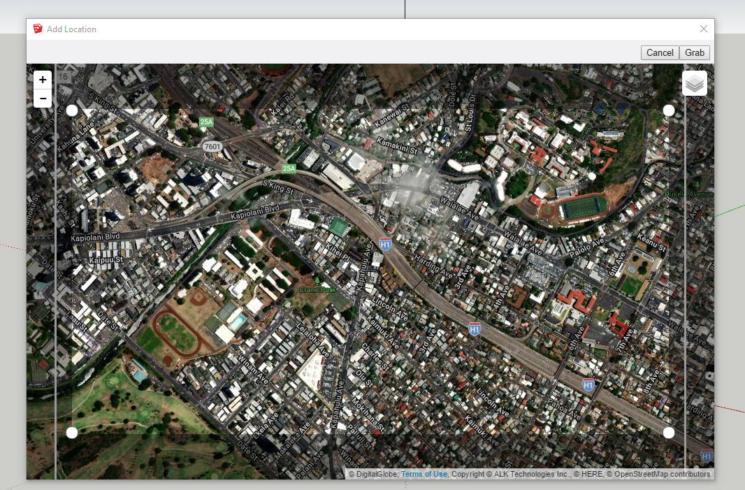
1. Open up Sketchup Pro and make sure the unit are set correctly with either imperial or metric. Go to File/ Geo-Location and add location:

2. Grab them. Ensure to match the Origin 0,0,0 with the current Revit origin in your project file.


3. Create 3D topo: Make an array of planes with 1 or 2 feet increment that cover the whole site, select all then Intersect Faces/ With Selection. Refer this youtube video for more detail. (https://www.youtube.com/watch?v=zN-BsxdvRRQ). The only difference I would made is to only create 3D line contours then export these 3D lines to dwg.

4. Open Revit, then import the dwg and follow the create topo from link tool:


5. Once you have a topo, you can make roads as floor/roof tool then use dynamo to attached road to the topo. You can then model the curbs/sidewalk using roof facial or slab edge tools. See video here: https://www.youtube.com/watch?v=Qk2KjeBntPE
Hope it helped.
STARBASE, access project controls - reinvented >>> it embodies people, process & systems that assure and enhance its operation
3yMax van Genderen
BIM Consultant / Virtual Design Contractor / Project Manager
4yUpdated: check out just released Dynamaps https://dynamobim.org/dynamaps/
Arquitecto, Especialista evaluación económicamente de Proyectos, S. de Información Geográfica, Profesional Inmobiliario.
5yGracias por Compartir!
Pim Jansen Daniël van der Voort Google Earth topografie naar Revit is misschien voor bepaalde projecten interessant
Program Management / Construction Management / BIM and VDC
5yBeen playing with the Infraworks to Civil 3D to Revit workflow for a bit. Great for conceptual and nice when you don’t have a survey yet. Seems to be a bit more accurate then pulling the topo from Google Earth